Surveyor is an executive/working surveying vocational trade. The duration of trade is one year with two semesters of six months each. The syllabus for the trade comprises mainly topics like how to prepare and maintain sketches, maps, reports, and legal descriptions of surveys in order to describe, certify, and assume liability for work performed; verify the accuracy of survey data, including measurements and calculations; direct or conduct surveys in order to establish legal boundaries for properties based on legal deeds and titles; record the results of surveys; calculate heights, depths, relative positions, property lines; prepare or supervise preparation of all data, charts, plots, maps, records and documents related to surveys. Trade is an important from job point of view which opens many jobs for students in various fields.
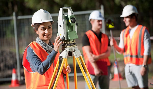
Introduction to Land Surveying
Master the tools and technical skills required to practice land surveying in this free online engineering course.
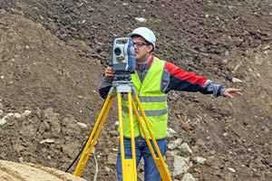
Before buildings are erected, land surveyors play an important role in mapping out their sites. Does this career path interest you? If so, this course is for you. We explain how to use the unique instruments used in the field and how to determine land mass. We also study relevant data processing methods and the essential safety standards used to reduce workplace risk. Sign up to pick up technical skills and begin your career as a land surveyor.
Chain Survey
chain survey/surveying is a very old method of Surveying. This article includes the definition of chain survey along with all detailed information with necessary images about various aspects of chain surveying.
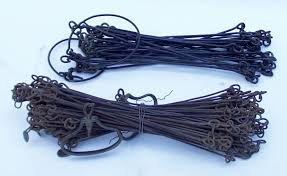
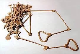
The chain survey is the simplest method of surveying. In the chain survey, only measurements are taken in the field, and the rest work, such as plotting calculation, etc. are done in the office. Here only linear measurements are made i.e. no angular measurements are made. This is most suitably adapted to small plane areas with very few details. If carefully done, it gives quite accurate results.
The necessary requirements for fieldwork are
Chain
Tape
Ranging-Rod
Arrows
Cross staff
Suitability of Chain Survey
Chain survey is suitable in the following cases: 1. The area to be surveyed is comparatively small 2. The ground is fairly level 3. The area is open and Details to be filled up are simple and less.
Survey Station
Survey stations are of two kinds
1. Main Stations
2. Subsidiary or tie
Main Stations
Main stations are the end of the lines, which command the boundaries of the survey, and the lines joining the main stations recalled the main survey line or the chain lines.
Subsidiary or the tie stations
Subsidiary or the tie stations are the points selected on the main survey lines, where it is necessary to locate the interior detail such as fences, hedges, building, etc.
Tie or Subsidiary Lines
A tie line joints two fixed points on the main survey lines. It helps to check the accuracy of surveying and to locate the interior details. The position of each tie line should be close to some features, such as paths, buildings, etc.
Base Lines
It is the main and longest line, which passes approximately through the center of the field. All the other measurements to show the details of the work are taken with respect to this line.
Check Line
A check-line also termed as a proof-line is a line joining the apex of a triangle to some fixed points on any two sides of a triangle. A check-line is measured to check the accuracy of the framework. The length of a checking line, as measured on the ground should agree with its length on the plan.
Offsets
Offsets are the lateral measurements from the baseline to fix the positions of the different objects of the work with respect to the baseline. These are generally set at right angle offsets. It can also be drawn with the help of a tape.
There are two kinds of offsets:
1. Perpendicular offsets
2. Oblique offsets.
The measurements are taken at a right angle to the survey line called perpendicular or right-angled offsets. For setting perpendicular offsets any one of the following methods is used:
Swinging
Using cross staffs
Using optical or prism square
Perpendicular Offset by Swinging:
The chain is stretched along the survey line. An assistant holds the end of the tape on the object. The surveyor swings the tape on chain line and selects the point on the chain where offset distance is the least and notes chain reading as well as offset reading in a field book on a neat sketch of the object. Perpendicular Offsets Using Cross Staffs.
Three different types of cross staffs used for setting perpendicular offsets. All cross staffs are having two perpendicular lines of sights. The cross staffs are mounted on a stand. The first line of sight is set along the chain line and without disturbing setting right angle line of sight is checked to locate the object. With open cross-staff it is possible to set perpendicular only, while with french cross-staff, an even 45º angle can be set. Adjustable cross-staff can be used to set any angle also since there are graduations and the upperdrum can be rotated over a lower drum.
Field Book
All observations and measurements taken during chain surveying are to be recorded in a standard field book. It is an oblong book of size 200 mm × 120 mm, which can be carried in the pocket.
There are two forms of the book.
i. single line.
ii. double line.
The pages of a single book are having a red line along the length of the paper in the middle of the width. It indicates the chain line. All chain-ages are written across it. The space on either side of the line is used for sketching the object and for noting offset distances. In the double line book, there are two blue lines with a space of 15 to 20 mm in the middle of each book. The space between the two lines is utilized for noting the chain-ages.
Procedure in Chain Survey
1. Reconnaissance: The preliminary inspection of the area to be surveyed is called reconnaissance. The surveyor inspects the area to be surveyed, surveyor prepares index sketch or key plan.
2. Marking Station: The surveyor fixes up the required no stations at places from where maximum possible stations are possible.
Some of the methods used for marking are:
o Fixing ranging poles
o Driving pegs
o Marking across if the ground is hard
o Digging and fixing a stone.
3. Then he selects the way for passing the mainline, which should be horizontal and clean as possible and should pass approximately through the center of work.
4. Then ranging roads are fixed on the stations.
5. After fixing the stations, chaining could be started.
6. Make ranging wherever necessary.
7. Measure the change and offset.
8. Enter in the field the book.
Level Survey
Levelling is one of the most important parts of surveying before starting the construction of roads, dams, or any other structures.
It is a branch of surveying which deals with the measurement of the elevation of the point with respect to the datum level above or below the surface of the ground.
In this article, you will get to know about the Types of levelling in surveying, the advantages, and disadvantages of levelling.
Surveyor Trade Required Skills
• Students are required to possess good problem-solving skills; excellent STEM skills (Science, Technology, Engineering and Maths) and the ability to work to a high degree of accuracy.
• They should have the ability to interpret data; strong communication, negotiation and presentation skills; the ability to prioritise and plan effectively.
• Students also have an understanding of the client’s business needs; a commitment to continuing professional development and the ability to work as part of a team.
• They also possess a comprehensive knowledge of building regulations; an understanding of planning legislation, and health and safety.
How is Surveyor Trade Beneficial?
• After passing trade successfully, they can work with local authorities, construction and engineering firms, building conservation bodies and specialist surveying practices.
• They can have jobs related to advice on property and construction, which spans across residential, commercial, industrial, leisure and agriculture projects.
• Students with good academic records and willing for further higher can go for Diploma/Bachelor Degree courses as it enhance their overall qualification.